
 Eat & Drink


 Travel


 Style
Style


 Beauty


 Health & Wellness


 Home & Decor


 Lifestyle
 Weddings


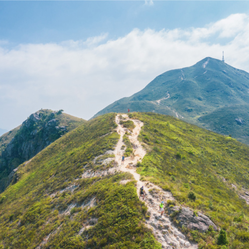
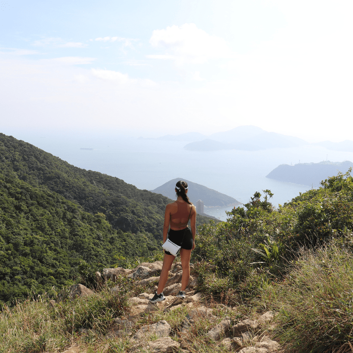
Looking for a challenging hiking trail to conquer this year? Here are seven of the hardest Hong Kong hikes to add to your bucket list.
If you’ve conquered Lion Rock and Dragon’s Back enough times, and feel ready to take the challenge to a new level, there’s no lack of hiking trails in Hong Kong. But if you’re looking to push yourself beyond your limits in the great outdoors, here are the seven of the hardest Hong Kong hikes for the brave of heart. So, skip the high intensity workout, pack your hiking gear and call your fitness buddies to explore some of the most challenging hikes this city has to offer.
Disclaimer: These are especially challenging hikes so it’s important to be prepared. Make sure to look up the difficulty of the trail route and take necessary precautions before and during your hike. Check the weather for high temperatures or unexpected rain, bring water, wear appropriate clothing and shoes, stay on the path and keep your mobile charged in case you need to make an emergency call.
Read More: Your Ultimate Hong Kong Hiking Trail Bucket List
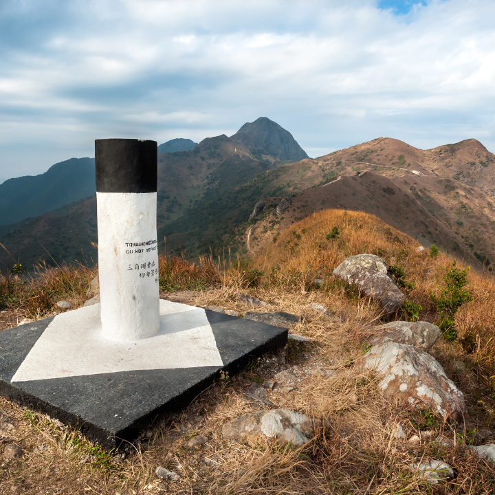
Twin Peaks & Violet Hill – 1,000 steps to the top
Involving 1,000 gruelling steps, this trek promises the reward of unbeatable views of Stanley and the outlying islands. The trail starts with a long, gradual hike up to Violet Hill (before you ask — no, this doesn’t count as any of the steps). As you descend the trail toward Repulse Bay, you will see an ominous indent running up the middle of the mountain in front of you — those are the steps. This is just the first twin, but don’t worry, the second is only about a quarter as big as the first. Once you reach the second summit, it’s all downhill to the road leading into Stanley!
How to get to Twin Peaks: From Exchange Square, take the Number 6 or Number 66 bus to Tai Tam Reservoir Road (Parkview). Alternatively, taxi it straight there. Starting from Parkview, take a left onto the main street and stay on that side of the road. You will see trail markers for the Hong Kong Trail on the opposite side of the street. About 50 metres past those signs on your side of the road, you will see a trail map at the bottom of some stairs leading into the woods adjacent to Parkview. Then simply follow the signs. The trail finishes on Stanley Gap Road at the Wilson Trail bus stop.
Distance: 5km
Duration: 2.5 hours
Getting home: If you want to go down to Stanley, take any of the buses or a taxi from the same side of the road where you have finished. To head to Central, cross the street and take a right to the bus stop where you can take the 6 or the 6A back into town.
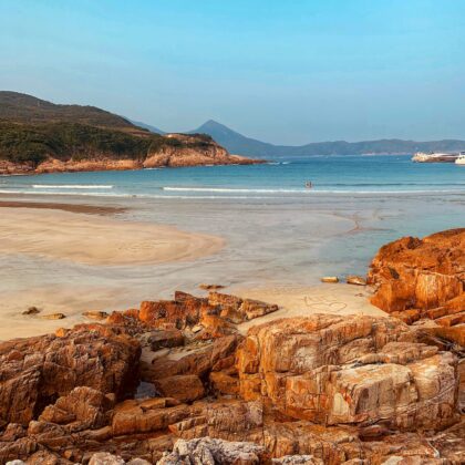
Read More: The Best Beach Hikes In Hong Kong
Tai Mo Shan – Hong Kong’s highest peak
Tai Mo Shan, literally, “Big Hat Mountain”, is the highest peak in Hong Kong, with an elevation of 957m. It’s worth mentioning that in the warmer months, the paths uphill are often swallowed up by fog (hence the name). Though this hike is not as difficult as it may sound, you’ll need to be prepared for the seemingly endless stairs at the beginning and towards the end of the trail (a pair of utility gloves will come in handy). At the top, you’ll see the highest point on Tai Mo Shan, occupied by a Hong Kong Observatory weather radar station. You can finally say you’ve reached the highest point in Hong Kong – enjoy sweeping views of green landscapes and feel on top of the world!
How to get to Tai Mo Shan: Take bus No. 51 at Tsuen Wan MTR Station and get off at Tai Mo Shan Country Park. Walk for around five minutes and you will reach the Twisk Management Centre, where MacLehose Trail Stage 8 starts. The first two kilometres are all about hiking up and there are well-paved stone steps along the way. Onwards, follow the MacLehose Trail signs and you will soon find yourself standing in front of a guard post at M152. Once you’ve passed the guard post, walk along the service road that will lead you up to Tai Mo Shan.
Distance: 10km (approx.)
Duration: 5 hours
Getting home: Either hike back out the way you came or descend from Lead Mine Pass (M140). Hike along the Wilson trail for 2km down and take the 23K green minibus to Tai Po Market MTR Station.
Read More: Where To Go With Your Dog – The Best Restaurants, Beaches, Hikes & Parks
Pyramid Hill – A conical hill starting from Ma On Shan Country Park
Pyramid Hill is part of MacLehose Trail Stage Four, which is considered one of the most difficult hikes of all trails. A prominent feature of Ma On Shan Country Park, the conical hill with a 536m summit is 12km in length and goes along the ridge of the hills, exposing hikers to all inclement weather. But with unbeatable views of Sai Kung Peninsula from the top, this hike is worth the challenge!
How to get to Pyramid Hill: Take village bus NR84 from Sunshine City Bus Terminal near Ma On Shan MTR and get off at Ma On Shan barbecue site (the bus only operates three times in the morning at 8am, 9am and 10:30am). If you take a taxi, ask the driver to drop you off at the village bus terminal (you’ll see a carpark). Take the staircase next to the terminal and begin the trekking. After around 20 minutes, you will reach an intersection with a pavilion, which marks the start of the MacLehose Trail Stage Four. Head right from there. After a few more minutes, you’ll reach an open plain where you’ll have a great view of Sai Kung, and behind you is Pyramid Hill.
Distance: 12km (approx.)
Duration: 4 hours
Getting home: After Pyramid Hill, at around M077, you will find stone steps descending to Kei Ling (approx. 2km). After passing by a camping site and a barbecue site, you will reach Sai Sha Road, where you can take buses to either Shatin (No. 99 or No. 299 bus) or Sai Kung.
Read More: The Best Waterfall Hikes In Hong Kong
Castle Peak – Steep slopes to the summit
Considered one of the three sharpest peaks in Hong Kong, Castle Peak (aka Tsing Shan) is the highest peak in northwest New Territories. We won’t lie to you, this is a challenging and physically demanding trail with steep slopes, but you will be rewarded with a spectacular panoramic view of Tuen Mun, Yuen Long Pak Nai from the summit, and even the airport and the Shenzhen Deep Bay on a clear day.
How to get to Castle Peak: The trail starts from Exit B of Tuen Mun Railway Station. Head to Hing Choi Street, walk to the end of the road and turn left to Tsing Shan Monastery Path. Keep walking uphill when you see the monumental archway. You will reach a junction where Tsing Shan Monastery is on the right, with the stairs to Castle Peak on the left. Turn left and you will reach a pavilion shortly. Pass through the pavilion, trace the path on the left, and then follow the long and steep flight of steps that winds along the hillside uphill with well paved steps at the initial section. Once you’ve reached the mid-level, the slope becomes gentle and you can take your time to enjoy a stunning view of Tuen Mun. Further up, the trail gets rougher and steeper. After steadily ascending, it leads to the pavilion near the summit. Taking the side path on the left towards the transmission facilities, it pushes to the hilltop.
Distance: 6km (approx.)
Duration: 5 hours
Getting home: Follow the main sandy trail on the ridge. Take the steep path next to the green construction and descend to Leung Tin Au where the road can lead you down to Leung King Estate. There minibus No. 48S, or bus No. 58M and 58X will get you to Mong Kok and various MTR stations.
Read More: The Best Beginner Hikes In Hong Kong
High Junk Peak – A tough but rewarding climb
Offering a 360-degree view of Clear Water Bay and the New Territories, High Junk Peak claims the highest accessible point on the Clear Water Bay Peninsula at 344 metres. Expect a few gravel sections and the occasional need to scramble up steep hillsides. There are a number of retreat points along the way, but with strong will and determination, you’ll arrive at the narrow summit in one piece and be rewarded with some breath-taking panoramic vistas at the top.
How to get to High Junk Peak: The starting point, Ng Fai Tin, can be reached from either Hong Kong Island or Kowloon. Take the No. 103M green minibus from Tsuen Kwan O MTR station, 103 green minibus from Kwun Tong, or bus 91 from Diamond Hill and alight at Ng Fai Tin. Cross the road and follow the steps up by the sign board for High Junk Peak.
Distance: 8.5km (approx.)
Duration: 3.5 hours
Getting home: From the High Junk Peak, continue down to Po Toi O then take 16 green minibus at the entrance of Po Tai Chun to MTR Po Lam station.
Read More: The Best Hikes In Kowloon
Shek Uk Shan – Sai Kung Peninsula’s highest hill
Contrary to popular belief, Sai Kung Peninsula’s highest hill is in fact Shek Uk Shan (481m), not Sharp Peak (468m). If the Sharp Peak was easy-peasy for you, take this lesser-known trail to really work on those hiking skills! This hiking trail is best for a sunset view of the lofty hill of Ma On Shan, Three Fathoms Cove and a distance view over Plover Cove Reservoir and Tolo Channel.
How to get to Shek Uk Shan: Take green minibus No. 7 from Sai Kung. Get off at Pak Sha O Youth Hostel and then follow the concrete path. After hiking for around 35 minutes, you’ll arrive at a junction. Turn left towards Sham Shung. After another 1km, you’ll reach a four-way junction. The path continues on to Sham Shung but you want to turn left instead and start bushwhacking (yes, you heard us right). This is the hardest part of the trail as it is overgrown and steep all the way up and you will have to climb for 2km until you reach the top of Shek Uk Shan.
Distance: 9km (approx.)
Duration: 5 to 6 hours
Getting home: Follow the signs to Pak Tam Au and you will see the signpost indicating MacLehose Trail Stage Three. Take the stairs going down to the road. Once you cross the road, you can take bus No. 96R to Diamond Hill or No. 94 to Sai Kung.
Read More: The Best Hong Kong Hikes That End With A Meal
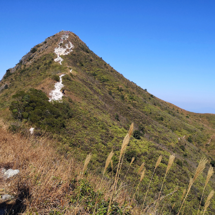
Sharp Peak – A challenging trail for experienced hikers
Dubbed as the ultimate Hong Kong wilderness hike, Sharp Peak (aka Nam She Tsim, meaning the hill of snakes) is a tough hiking trail for experienced hikers. Sharp Peak is known for its winding and rugged mountain paths and therefore a good level of fitness is required for this hike. The most challenging part of the hike is towards the end, when you need to climb/clamber up a steep and strenuous cliff, which eventually leads you up to the hilltop. Once you’ve successfully made it to the summit, you’ll be rewarded by magnificent views of wondrous natural landscapes. In the northwest is the scenery of Pat Sin Leng mountain range and Plover Cove Reservoir, while Mirs Bay, Grass Island and other outlying islands are found in the northeast.
How to get to Sharp Peak: From Sai Kung, take a taxi to the Eastern part of the High Island Reservoir (it’s a restricted area, so no public transport is available). Once you get off, walk past the principal dam and the pavilion, turn left and you will have reached the starting point of the hike. After 20 minutes or so, you will arrive at the paradisiacal and nicely shaded Long Ke beach, a lovely spot for picnics and camping. From there, follow the trail for another 300m and you will reach the merging point with the trail that hikers coming from Sai Kung take (a much easier option). Head right and you will arrive in Sai Wan village (with local restaurants for a food break). Walk through the village and you will find Sai Wan beach, where your second leg of the hike begins. After 30 to 40 minutes, and a few photo stops, you will have reached Ham Tin Wan, where you can restock your food and water supply. Once you’re done, keep hiking up for another 2km from Ham Tin beach (between M039 and M040). You will reach a bench at the top of a hill with a sign that describes Sharp Peak. At this point, you must decide whether you still have the energy to tackle a strenuous 2km cliff, followed by a no-less challenging 2km down back to your current location.
Distance: 15km (approx.)
Duration: 6 to 7 hours
Getting home: Keep going on the MacLehose until you reach M042. Take the stairs on the right that go down towards the bay and follow the path to the pier, where you will find boats to Wong Shek pier. It costs $150 to charter the boat, so if you’re alone, it’s worth waiting for other hikers to join and share the cost.
Read More: Top 5 Night Hikes In Hong Kong
Editor’s Note: “Your Guide To The Hardest Hong Kong Hikes To Tackle This Year” was most recently updated by Nicole Moraleda in January 2023. With thanks to Pearl Yan and Tania Shroff for their contribution.